
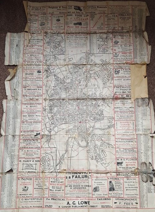
The Handy Map and Street Guide to Nottingham dates from around 1920. It is a crude street plan designed to be posted on a wall and contains several businesses advertising on it. Many of the advertisers are in the Mapperley area and this this version would appear to have been produced and sold in this area.
Measuring 90 x 64 cm, it has columns down the sides with an alphabetical index to the street names. It was probably produced as a wall plan, but had been folded up.
The map is not dated but there are aspects of it that suggest it is from around 1920.
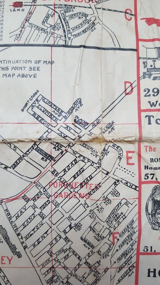
Porchester Gardens
This section of the street plan shows the tram line on Woodborough Road ending at the top of Westdale Lane and the Porchester Gardens estate marked in red.
Tram routes are indicated by a red line down the centre of the road.
There is a tram route marked on Woodborough Road ending at the junction with Westdale Lane. The tram to Mapperley ceased in 1936 with the arrival of the motor car.
In 1931 the Nattriss family started their car sales and servicing on Porchester Road. The family raced vintage sports cars. Our obsession with the motor car was under way and unsurprisingly, the tramcar (which had extended to Westdale Lane) ceased operating 1936.
Lunatic Hospital
The term Lunatic Hospital ceased to be used officially from 1930.
The other term used on the map is Lunatic Hospital to indicate the Coppice Hospital on Coppice Road. This is now known as Ransom Road in Mapperley. Mapperley Hospital on Porchester Road is referred to as Lunatic Asylum.

Lunatic Hospital off Coppice Road (now Ransom Road)
Prior to the building of Mapperley Hospital the mentally ill were kept at The General Lunatic Asylum that was on Carlton Road in Sneinton where King Edward park is now.
Old Lenton
When you look on the map for our current hospitals, the area of the Queens Medical Centre is barely recognisable. We now have the Ring-Road and the industrial area of Lenton. There is a road called Trent Lane that goes from Leen Gate directly to the river. This appears to be the line that the ring road takes to Clifton Bridge. There is no river crossing here and the nearest option would have been Wilford (toll) Bridge. Ironically this is now on the new tram route.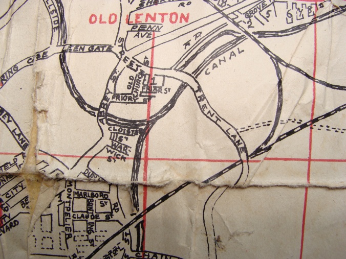
Bagthorpe Workhouse
The City Hospital is marked by a rather different title; The Bagthorpe Workhouse. The area between Hucknall Road, Sherwood and Nottingham Road, New Basford appears undeveloped. The Prison at Perry Road is titled His Majesty’s Prison.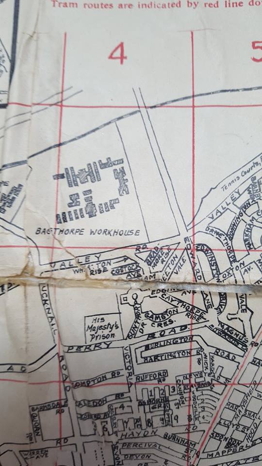
Bagthorpe Workhouse and Prison
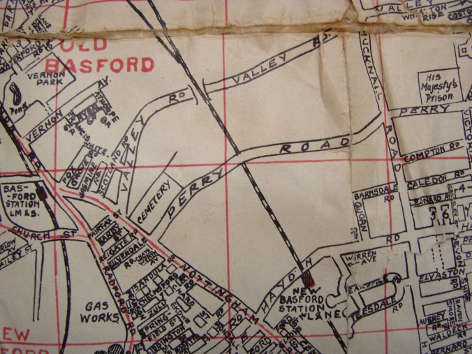
Valley Road in Basford (now forming part of the ring road). The area undeveloped by housing.
Here are some of the businesses advertising on the map.
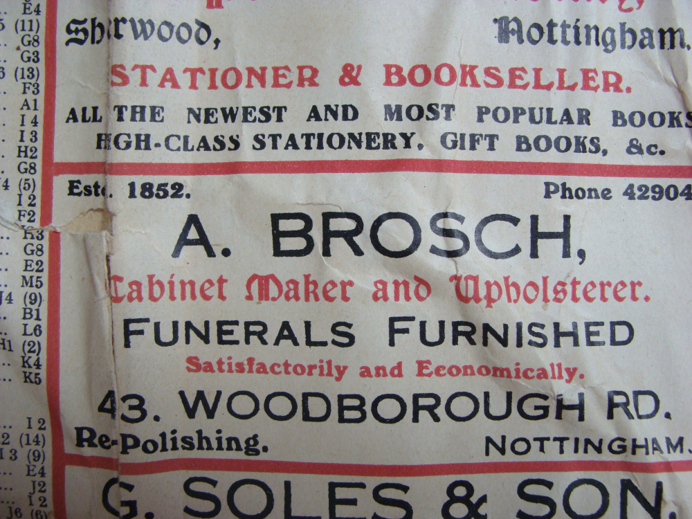

A Brosch Cabinet Maker and Upholsterer of 43 Woodborough Road, Nottingham.
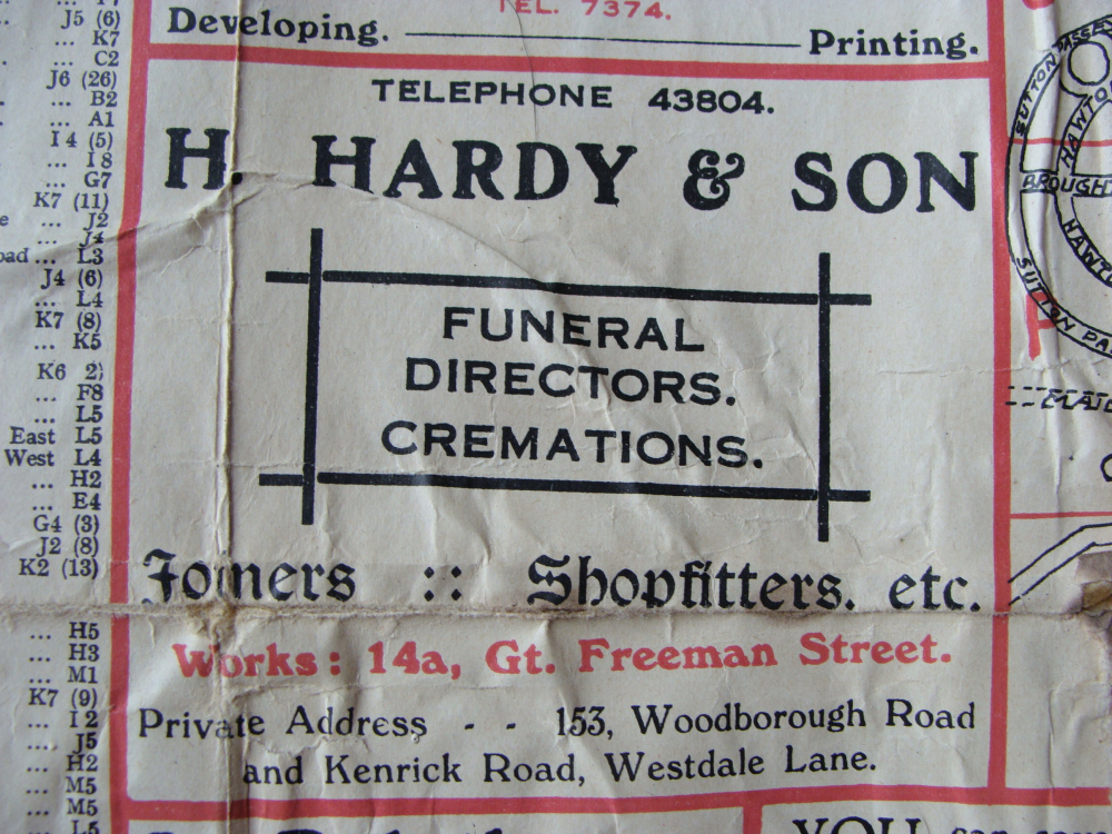
H Hardy and Son, Funeral Directors of 153 Woodborough Road and Kenrick Road
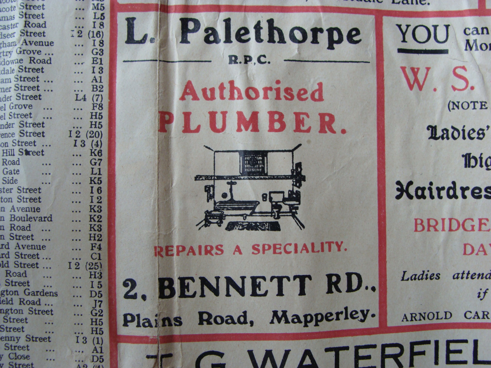
L Palethorpe, Authorised Plumber of 2 Bennett Road, Plains Road, Mapperley.
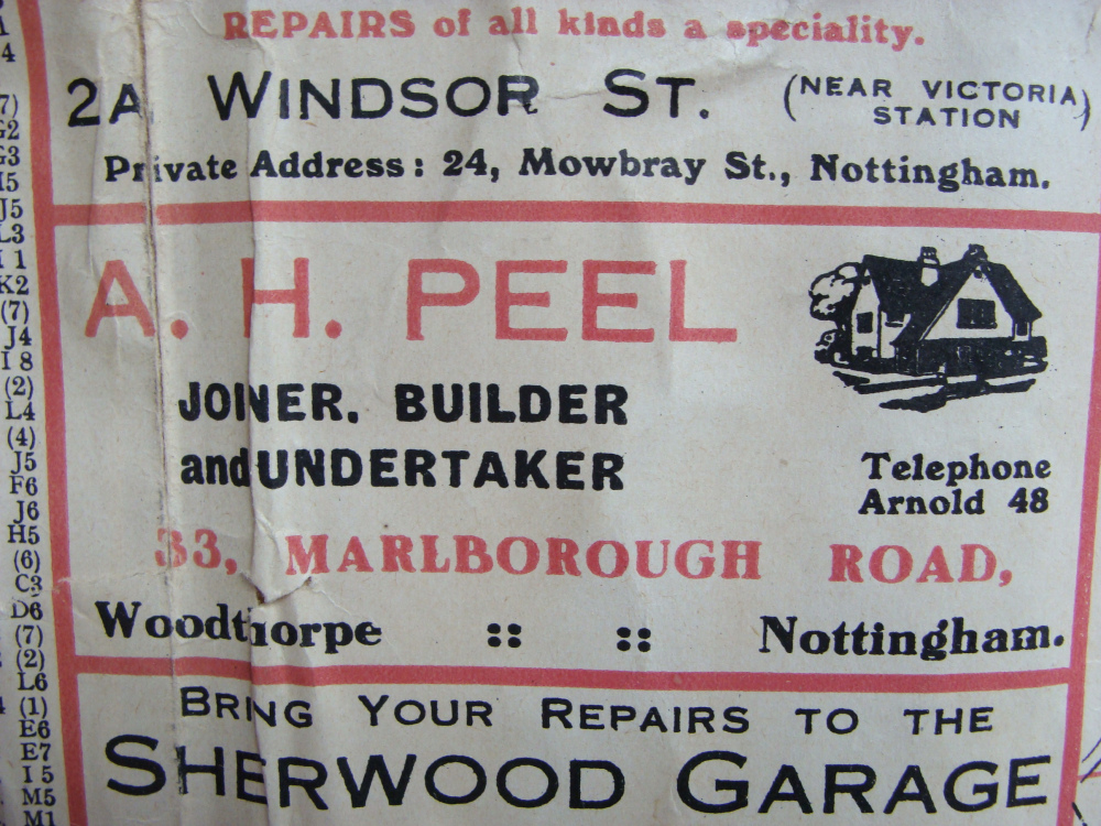
A H Peel, Joiner Builder and Undertaker of 33 Marlborough Road, Woodthorpe.
T F Ebblewhite, Electrical Engineer of 118 Sandford Road, Mapperley.
Graham Palmer
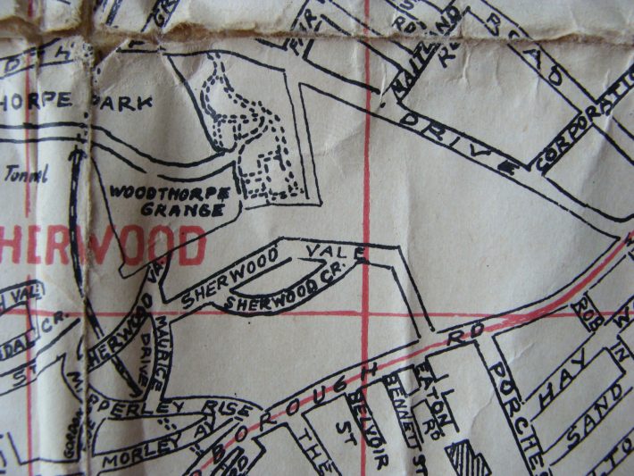
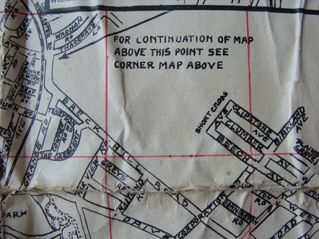
The last but one picture (Breck Hill Road) shows a road crossing it called Corporation Road. I suspect that this is a mis-print, as it has always been called Coronation Road as far as I am aware.
Editor
That’s a good spot Graham. Thanks for letting us know.
Editor
That’s a good spot Graham. Thanks for letting us know.
Steve Buxton
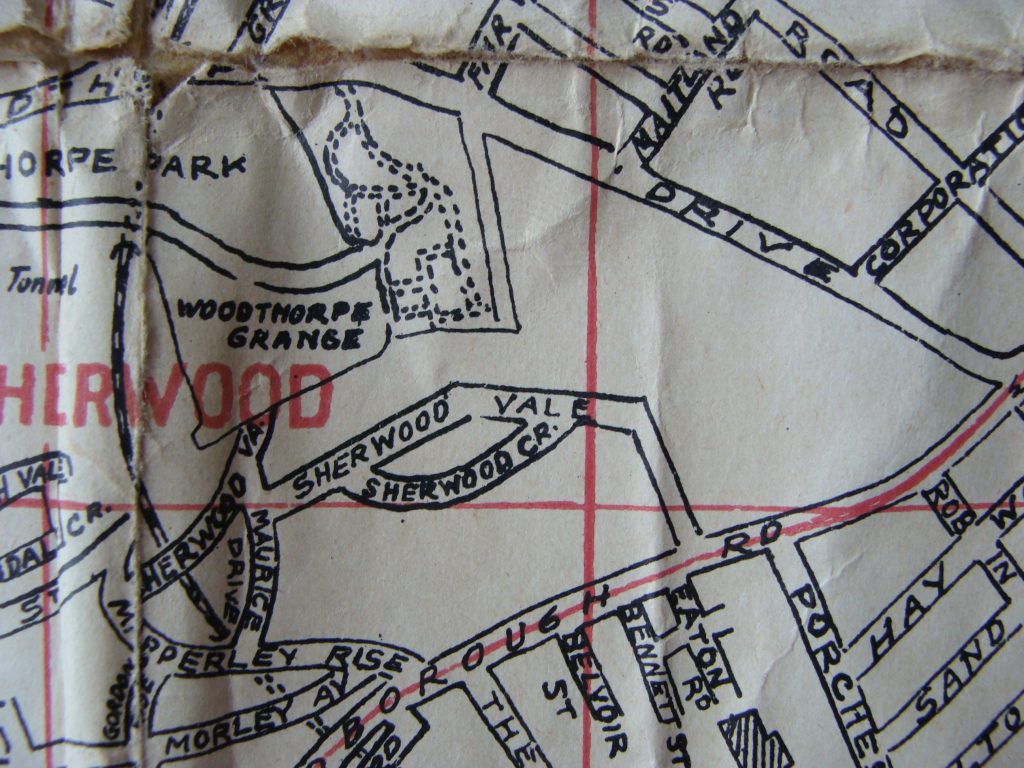
Maurice Drive is shown as connecting with Sherwood Vale but it is a cul-de-sac.
Editor
Good spot Steve. Thanks
Editor
Good spot Steve. Thanks
Elizabeth Payne
This is a lovely piece of history. Isn’t there a clever printer type person who could restore or reproduce this and sell it to the folk of Mapperley. I’m sure it would sell
Editor
That’s not a bad idea Elizabeth. Thanks
Anon
Interesting that Blyth Street and Staples St in Mapperley are the wrong way round or did they change?
Editor
Good spot Rosemary. Probably an error as it is a cheap quality street plan.